


Sandoval County Precinct 29, Sandoval County, New Mexico
About
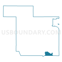
Outline

Summary
| Unique Area Identifier | 623889 |
| Name | Sandoval County Precinct 29 |
| County | Sandoval County |
| State | New Mexico |
| Area (square miles) | 42.33 |
| Land Area (square miles) | 42.31 |
| Water Area (square miles) | 0.02 |
| % of Land Area | 99.96 |
| % of Water Area | 0.04 |
| Latitude of the Internal Point | 35.24281370 |
| Longtitude of the Internal Point | -106.52446620 |
Maps


Graphs
Select a template below for downloading or customizing gragh for Sandoval County Precinct 29, Sandoval County, New Mexico


Neighbors
Neighoring Voting District (by Name) Neighboring Voting District on the Map
- Bernalillo County Precinct 556, Bernalillo County, NM
- Bernalillo County Precinct 567, Bernalillo County, NM
- Bernalillo County Precinct 569, Bernalillo County, NM
- Bernalillo County Precinct 573, Bernalillo County, NM
- Bernalillo County Precinct 6, Bernalillo County, NM
- Bernalillo County Precinct 86, Bernalillo County, NM
- Sandoval County Precinct 1, Sandoval County, NM
- Sandoval County Precinct 11, Sandoval County, NM
- Sandoval County Precinct 2, Sandoval County, NM
- Sandoval County Precinct 28, Sandoval County, NM
- Sandoval County Precinct 5, Sandoval County, NM
- Sandoval County Precinct 55, Sandoval County, NM
- Sandoval County Precinct 64, Sandoval County, NM
- Sandoval County Precinct 74, Sandoval County, NM
- Sandoval County Precinct 77, Sandoval County, NM
Top 10 Neighboring County Subdivision (by Population) Neighboring County Subdivision on the Map
- Albuquerque CCD, Bernalillo County, NM (633,223)
- Rio Rancho CCD, Sandoval County, NM (113,761)
- East Bernalillo CCD, Bernalillo County, NM (19,056)
Top 10 Neighboring Place (by Population) Neighboring Place on the Map
Top 10 Neighboring Unified School District (by Population) Neighboring Unified School District on the Map
Top 10 Neighboring State Legislative District Lower Chamber (by Population) Neighboring State Legislative District Lower Chamber on the Map
- State House District 44, NM (51,046)
- State House District 15, NM (31,051)
- State House District 23, NM (30,981)
- State House District 22, NM (29,758)
- State House District 65, NM (26,930)
Top 10 Neighboring State Legislative District Upper Chamber (by Population) Neighboring State Legislative District Upper Chamber on the Map
- State Senate District 10, NM (57,103)
- State Senate District 9, NM (52,758)
- State Senate District 21, NM (48,064)
- State Senate District 19, NM (45,690)
Top 10 Neighboring 111th Congressional District (by Population) Neighboring 111th Congressional District on the Map
Top 10 Neighboring Census Tract (by Population) Neighboring Census Tract on the Map
- Census Tract 111, Sandoval County, NM (6,812)
- Census Tract 9405, Sandoval County, NM (4,249)
- Census Tract 105.03, Sandoval County, NM (3,425)
- Census Tract 38.03, Bernalillo County, NM (3,180)
- Census Tract 9405, Bernalillo County, NM (2,859)
- Census Tract 38.05, Bernalillo County, NM (2,426)
Top 10 Neighboring 5-Digit ZIP Code Tabulation Area (by Population) Neighboring 5-Digit ZIP Code Tabulation Area on the Map
- 87114, NM (61,623)
- 87122, NM (17,977)
- 87113, NM (14,477)
- 87004, NM (10,136)
- 87043, NM (5,052)
- 87047, NM (4,894)
- 87008, NM (2,552)